February 02, 2025, 20:18:00 GMT
permalink Post: 11820075
If the aircraft were at a close to 90-degree intersection, then the CRJ700 would have been moving across the field of vision right in front of the helicopter, thus making the collision all the more perplexing, not withstanding night vision goggles (if indeed worn) interfere with depth perception and can reduce field of view to as low as 40\xb0. Of course there also remains the reported disparity in flying height, with the UH-60 100 feet above it's flight ceiling
Subjects
Blackhawk (H-60)
Links are to this post in the relevant subject page so that this post can be seen in context.
Reply to this quoting this original post. You need to be logged in. Not available on closed threads.
February 02, 2025, 20:28:00 GMT
permalink Post: 11820083
If the aircraft were at a close to 90-degree intersection, then the CRJ700 would have been moving across the field of vision right in front of the helicopter, thus making the collision all the more perplexing, not withstanding night vision goggles (if indeed worn) interfere with depth perception and can reduce field of view to as low as 40\xb0. Of course there also remains the reported disparity in flying height, with the UH-60 100 feet above it's flight ceiling
Subjects
Blackhawk (H-60)
CRJ
Links are to this post in the relevant subject page so that this post can be seen in context.
Reply to this quoting this original post. You need to be logged in. Not available on closed threads.
February 02, 2025, 20:30:00 GMT
permalink Post: 11820088
If the aircraft were at a close to 90-degree intersection, then the CRJ700 would have been moving across the field of vision right in front of the helicopter, thus making the collision all the more perplexing, not withstanding night vision goggles (if indeed worn) interfere with depth perception. Of course there also remains the reported disparity in flying height, with the UH-60 100 feet above it's flight ceiling
Subjects
Blackhawk (H-60)
Links are to this post in the relevant subject page so that this post can be seen in context.
Reply to this quoting this original post. You need to be logged in. Not available on closed threads.
February 02, 2025, 20:31:00 GMT
permalink Post: 11820089
Subjects
ADSB (All)
ADSB In
ADSB Out
Blackhawk (H-60)
TCAS (All)
TCAS RA
Links are to this post in the relevant subject page so that this post can be seen in context.
Reply to this quoting this original post. You need to be logged in. Not available on closed threads.
February 02, 2025, 21:03:00 GMT
permalink Post: 11820111
If the aircraft were at a close to 90-degree intersection, then the CRJ700 would have been moving across the field of vision right in front of the helicopter, thus making the collision all the more perplexing, not withstanding night vision goggles (if indeed worn) interfere with depth perception and can reduce field of view to as low as 40\xb0. Of course there also remains the reported disparity in flying height, with the UH-60 100 feet above it's flight ceiling
I can't access the METAR history any more, but I think it was 270V330 with gusts above 20kts. With the helo showing a groundspeed of 80kts on the radar trace, a westerly wind of just 12kts would give 9 degrees of drift and therefore a helo heading of 196, putting the CRJ just outside the 20 degree semi-angle of NVG with 40 degree field of view if the pilots were looking straight ahead.
If anyone can supply the METAR info (there was a report just 10mins after the accident), I'll update my radar diagram with the helo heading and a superimposed field of view. (Edit: done at #729 )
Last edited by Easy Street; 3rd February 2025 at 02:04 .
Subjects
Blackhawk (H-60)
CRJ
Night Vision Goggles (NVG)
Radar
Links are to this post in the relevant subject page so that this post can be seen in context.
Reply to this quoting this original post. You need to be logged in. Not available on closed threads.
February 02, 2025, 23:05:00 GMT
permalink Post: 11820185
1. In an effort to maximize commercial air traffic in and out of DCA, the FAA has created the “deviate to RWY 33 procedure” for air traffic in-bound to RWY 01. This requires a right-hand turn from the RWY 01 approach followed by an immediate hard left-hand turn to line up on RWY 33. FAA criteria for a stabilized approach states that you have to be stable at 500 feet AGL on final in VMC or perform an immediate go-around. But on this particular approach, you will be at or below 400 feet AGL as you come out of the left turn to final. So the FAA has granted an exception to the “stabilized requirements” at DCA to allow for this maneuver. This allows ATC to shorten the distance between arriving and departing aircraft that are utilizing conflicting RWYs. The FAA in essence violates its own safety standards on stabilized approaches for the sake of expediency.
2. The FAA creates the Route 1/4 helicopter route through the DCA airspace as a VFR route with constantly changing altitude requirements. The lowest limit is at 200 ft MSL through the area east of DCA. Any pilot will tell you that flying that low over water at night is a best a tense experience. Try not to break that limit flying at night while also trying to communicate with ATC and simultaneously searching for possible conflicting aircraft.
3. The United States Army Aviation Branch deems it acceptable to allow training missions for Army Reserve pilots with limited flying experience to fly these helicopter routes through this complex and extremely active airspace. Compounding this, training flights at night using night-vision goggles are deemed “safe” in spite of the fact that using said goggles severely limits peripheral vision and makes it difficult if not impossible to perceive any color other than green and white. Picking out particular lights against the background of urban lighting is challenging, as is depth perception. Scanning key cockpit instruments is also made more difficult, making it challenging to accurately maintain altitude. Add to that workload the need to be in constant communication with ATC as well as monitoring all other comms traffic not directed to you but necessary in order to maintain good situational awareness. Given the density of commercial air traffic on this route, common sense would dictate that this route be flown by only the most experienced pilots and only when absolutely necessary. Reasonable logic would understand that conducting training missions should not be using final approach areas with heavy commercial traffic.
4. The Army crew on PAT25 are flying a mission they have been ordered to fly, at night and using night vision goggles. Although they may feel it is difficult and may be anxious about it, their command structure has determined that it is an appropriate training procedure and as such must meet minimum safety requirements. They do not have the authority to question the mission or the orders to fly it.
5. JIA342 is on approach for RWY 01, but is asked at the last minute by ATC to deviate to RWY 33, requiring the “circle to land” maneuver. Therefore, they are now on approach different from what they briefed for.
6. Any aircraft following the “circle to land” approach to RWY 33 will most likely have both pilots focused on RWY 33 as they come out of the left turn to final, especially if it was a last-minute request by ATC. In this case they will be looking to make sure that AA1630, which has just been given clearance to depart from RWY 01, is clear of the intersection with RWY 33 as they complete their final approach, and be ready for a go-around if it is not. In addition, this left bank makes it extremely difficult for the first officer to see any conflicting traffic coming towards them from the 1 to 2 o’clock position, as that traffic will probably be below the right window level. For the pilot, who is on the left side of the cockpit, visibility of such conflicting traffic will be nearly impossible.
7. For whatever reason, ATC is working with “split frequencies while controlling this airspace, so that although the controller hears both the aircraft on approach and the helo traffic south-bound on “Route 1”, the pilots of those respective aircraft only hear information directed at them. Thus they are not aware of all that is going on around them, and as such their situational awareness is limited by factors outside of their control.
8. ATC informs PAT25 of the conflicting aircraft on approach for RWY 33 at 1200 feet MSL, but at the time, PAT25 is heading almost due east towards the Jefferson Memorial on Helo Route 4 while JIA342 (the CRJ) is executing its right turn departing from the RWY 01 approach and is now heading in a northeast direction as it prepares to make a hard left onto the RWY 33 short final approach. From their respective positions, PAT25 in all likelihood sees the landing lights of AA3130 which is trailing JIA342 and whose landing lights are pointed almost directly in his direction, and mistakenly identifies it as the aircraft approaching RWY 33. At no time does it appear that ATC notifies JIA342 of the conflicting helo traffic. They are most likely focused on their approach to RWY 33, which was just handed to them.
9. As JIA342 rolls out of its left hand turn to final on RWY 33, completing the deviation they were just handed and had not briefed for, it is now approaching the 9-11 o’clock position of PAT25. Since the pilot of PAT25 is on the right-hand side of the Blackhawk, visibility of the CRJ may be limited. Both pilots of PAT25 are now most likely visibly fixated on passing to the rear of AA3130, which is in their 1-3 O’clock position, and which is the conflicting aircraft they perceive as the one ATC initially warned them about.
10. ATC, now receiving a conflicting aircraft warning, asks PAT25 if they have JIA342 in sight. In the absence of any obvious difference from the first mid-identification of the conflicting traffic, confirmation bias raises its ugly head. The voice response from the training pilot is calm and confident in stating that they do have it in sight and claim visual separation, probably proving once again that he mistakenly has AA3130 in sight slightly to his right directly in front of him and more than a mile away. Both pilots are totally unaware of JIA342 which is now arriving in front of them from their left.
11. The collision occurs.
In my humble opinion, the crews of both aircraft involved were set up by both the FAA and the Army Department of Aviation through a series of poorly based decisions which focused on expediency and departed from any appropriate utilization of a rational use of risk assessment. Consider the following:
1. Approval of the circling to RWY 33 maneuver which violates normal stabilized approach standards.
2. The establishment of a series of complex VFR helicopter track complex and heavily restricted air space as well as through final approach paths.
3. A 200 foot maximum altitude requirement over water and required even at night, which may result in a less than 200 foot vertical separation between aircraft on approach to RWY 33 and those traveling on Helo Route 1/4.
4. The decision to conduct military training missions in this complex and busy airspace with an abundance of commercial passenger traffic either arriving to or departing from DCA.
5. The use of split frequencies by the FAA which negatively impacts the situational awareness of all of the pilots in the airspace.
6. The use of night vision goggles to place even more limitations on the pilots.
Granted, all pilots involved may not have had the thousands of hours senior commercial and military pilot possess. But even the most senior individuals when placed in the task saturated environments these two crews faced would have at the very least felt their “pucker factor” increase through this. And there is probably an equal chance that the lack of common sense and appropriate safety design exhibited by the controlling entities would have resulted in a similar outcome. The odds were significantly stacked against these two flight crews, and unfortunately, against the passengers and flight attendants as well. If ever there were an example of an accident waiting to happen, this is it.
Subjects
ATC
Accident Waiting to Happen
Blackhawk (H-60)
CRJ
DCA
FAA
NTSB
PAT25
Route 4
Separation (ALL)
Situational Awareness
VFR
Vertical Separation
Visual Separation
Links are to this post in the relevant subject page so that this post can be seen in context.
Reply to this quoting this original post. You need to be logged in. Not available on closed threads.
February 03, 2025, 01:03:00 GMT
permalink Post: 11820210
What I can say about Mike is: he puts his name and his face and his reputation out there in public to have open discussions about flight safety, and in the context of this totally preventable collision, it would be beneficial to all if every expert here and elsewhere on the interwebs participated in a similarly open and public debate in relation to this incident. If you disagree with him, message him and invite a public debate.
I've lurked and read this forum for a long time. Decades? I can't even remember how long. Much as I enjoy reading it when a major incident occurs, it frustrates me to no end how it is filled with so many examples of institutional inertia, acquiescence to mind-numbingly antiquated regulations, ridiculous politics, and endless excuses, all of which inhibit the progress of technology and safety...not to segue into a rant but the most obvious example being, and which 99% of the non-flying public would agree with, that there is almost zero reason at this point to not have cameras in the cockpit and perhaps even live transmission of video and/or audio feeds on every commercial aircraft at this point \x96 the power and data/bandwidth requirements being miniscule relative to the benefits, at this point it is simply absurd that such features do not exist; the Jeju incident's loss of CVR data being the best recent example of what a hindrance to technological progress aviation regulations have become, when for a few dollars a consumer can own a tiny little dashcam that records stunning 4K video and broadcast quality audio in near total darkness with 100mph wind noise running on a small and safe lithium batteries trickle charged from a 5 watt power supply for days on end, which can be broadcast via wifi link to Starlink-satellite based internet across the entire planet. We live in the Space Age, but the data storage and recovery procedures for commercial aircraft still hearkens back to WW2...
That rant aside, as the videos posted above by others demonstrate:
- A Blackhawk can in fact stop on a dime (so whatever you're suggesting Mike Blackstone was wrong about, it certainly wasn't that).
- Obviously that shouldn't be the plan , but it still a legitimate question to ask, in the context of an emergency, and when every other safety precaution has already failed, why couldn't it be done? Other poster's rationalize: at the low altitude, there's nowhere to go. The videos demonstrate otherwise. You can stop a Blackhawk 50 feet above the ground in seconds. If deviating in any direction is a risk, why didn't ATC just say " PAT25 slow to stop and hover!" \x96 as a Very. Last. Resort?
- I don't understand how we can have a system of "Air Traffic Control" that defers its control to aircraft at night around a busy airport with intersecting approaches. It's nonsensical. I honestly didn't know it was a thing. I thought all major airports had flight paths that kept inbound and outbound aircraft in separate non-conflicting lanes at all times. Obviously, I'm extremely naive. From my perspective, it seems as though the professionals involved are allowed no intuition to deviate when the procedures clearly compromise safety? Apparently they're all reduced to being bots who can only read checklists? If that's the case, then why not run the whole system on "AI"? I know I'm being spicy by saying that, given all the pilots on this forum who harp on about how stupid AI is (true for the moment, but not for much longer, rest assured), yet many consider it perfectly reasonable for ATC procedures being to read out the type of aircraft to a pilot who is flying in total darkness in order to fulfill delegation of its responsibility to control air traffic, as if that procedure actually helps? Are we through the looking glass? It doesn't take a three year NTSB investigation to infer how stupid that is. Yet some defend it. Why?
Subjects
ATC
Blackhawk (H-60)
CVR
Hover
NTSB
PAT25
Links are to this post in the relevant subject page so that this post can be seen in context.
Reply to this quoting this original post. You need to be logged in. Not available on closed threads.
February 03, 2025, 01:54:00 GMT
permalink Post: 11820223
- A Blackhawk can in fact stop on a dime (so whatever you're suggesting Mike Blackstone was wrong about, it certainly wasn't that).
- Obviously that shouldn't be the plan , but it still a legitimate question to ask, in the context of an emergency, and when every other safety precaution has already failed, why couldn't it be done? Other poster's rationalize: at the low altitude, there's nowhere to go. The videos demonstrate otherwise. You can stop a Blackhawk 50 feet above the ground in seconds. If deviating in any direction is a risk, why didn't ATC just say " PAT25 slow to stop and hover!" – as a Very. Last. Resort?
My experience? 15,000 hours rotary with at least 4-5,000 hours below 200', 1,500 night hours, Mil/Civil mix of mediums (21,000lb) down to horrid little clockwork toys.
No further online discussion from me, but it would be interesting to know your pilot qualifications to post here with such assumed authority, please?
Subjects
ATC
Blackhawk (H-60)
Hover
Night Vision Goggles (NVG)
PAT25
Links are to this post in the relevant subject page so that this post can be seen in context.
Reply to this quoting this original post. You need to be logged in. Not available on closed threads.
February 03, 2025, 03:43:00 GMT
permalink Post: 11820254
Mid-Air Collision - US Military Blackhawk & Regional Jet
That's private pilot stuff. I'd question anything he has to say.
Subjects
Blackhawk (H-60)
Links are to this post in the relevant subject page so that this post can be seen in context.
Reply to this quoting this original post. You need to be logged in. Not available on closed threads.
February 03, 2025, 06:44:00 GMT
permalink Post: 11820286
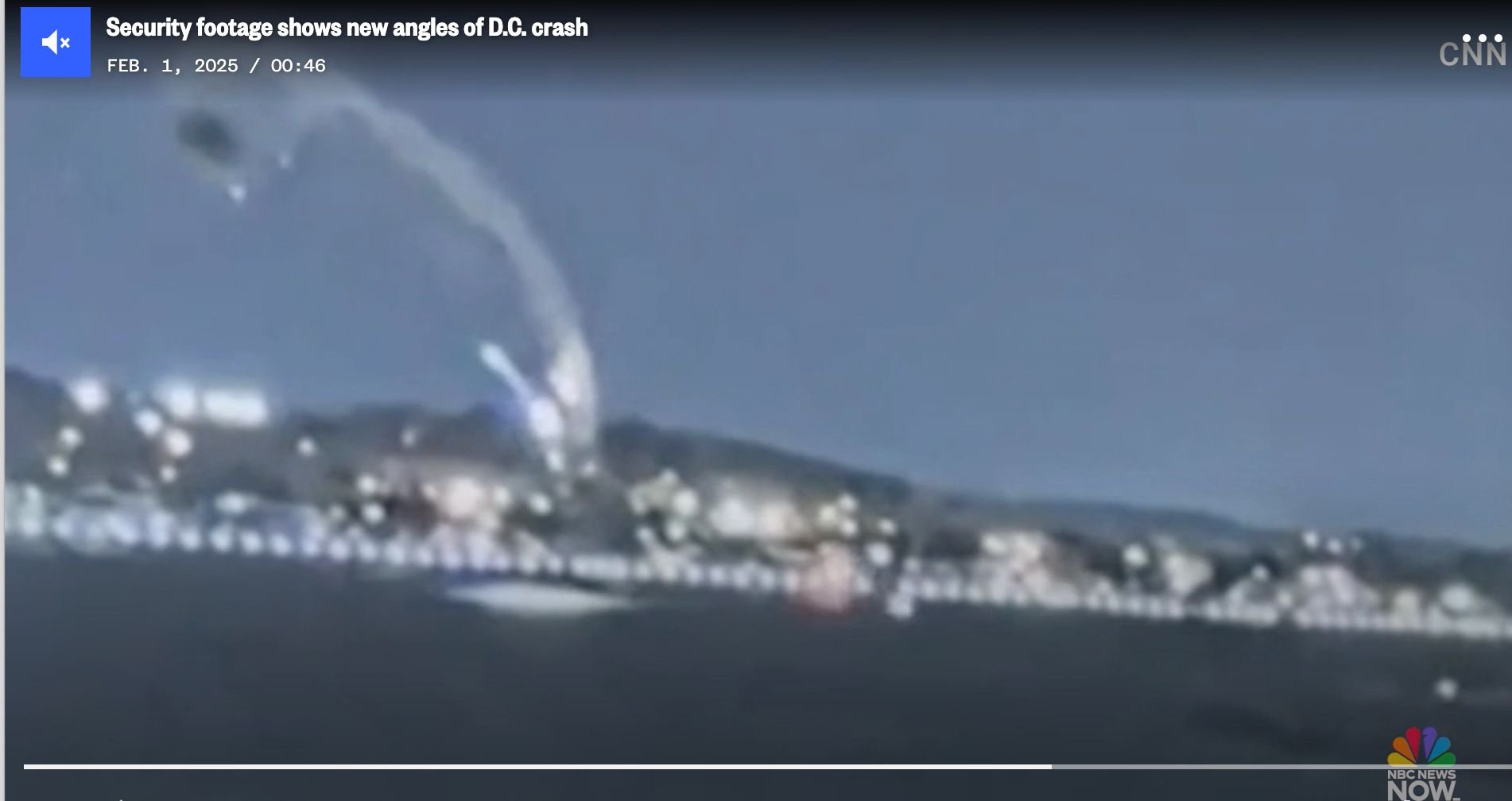
It's at about 31 seconds into this video
Subjects
Blackhawk (H-60)
NBC
Links are to this post in the relevant subject page so that this post can be seen in context.
Reply to this quoting this original post. You need to be logged in. Not available on closed threads.
February 03, 2025, 10:18:00 GMT
permalink Post: 11820382
Can we please get away from the idea that there is a direct equivalence between the hours flown by military pilots and those flown in commercial air transport types?
Subjects
Blackhawk (H-60)
IFR
Links are to this post in the relevant subject page so that this post can be seen in context.
Reply to this quoting this original post. You need to be logged in. Not available on closed threads.
February 03, 2025, 11:08:00 GMT
permalink Post: 11820420
9. As JIA342 rolls out of its left hand turn to final on RWY 33, completing the deviation they were just handed and had not briefed for, it is now approaching the 9-11 o\x92clock position of PAT25. Since the pilot of PAT25 is on the right-hand side of the Blackhawk, visibility of the CRJ may be limited. Both pilots of PAT25 are now most likely visibly fixated on passing to the rear of AA3130, which is in their 1-3 O\x92clock position, and which is the conflicting aircraft they perceive as the one ATC initially warned them about.
Subjects
ATC
Blackhawk (H-60)
CRJ
DCA
Night Vision Goggles (NVG)
PAT25
Route 4
Links are to this post in the relevant subject page so that this post can be seen in context.
Reply to this quoting this original post. You need to be logged in. Not available on closed threads.
February 03, 2025, 11:39:00 GMT
permalink Post: 11820447
Last edited by PPRuNeUser548247; 3rd February 2025 at 12:18 .
Subjects
Blackhawk (H-60)
DCA
Situational Awareness
Links are to this post in the relevant subject page so that this post can be seen in context.
Reply to this quoting this original post. You need to be logged in. Not available on closed threads.
February 03, 2025, 12:44:00 GMT
permalink Post: 11820506
https://www.washingtonpost.com/dc-md...ues-point-dei/
Crews are set to begin lifting a catastrophically damaged American Airlines regional jet from the bottom of the Potomac River in Washington on Monday, five days after the plane and an Army helicopter collided in a fiery crash that left no survivors .
What’s left of the plane will be carefully brought to the surface with the help of Navy salvage experts and specialized dive teams who have been rehearsing the effort, according to Col. Francis Pera, the Baltimore district commander for the U.S. Army Corps of Engineers, which is helping oversee the work.
The Army Corps said the process could take three days to complete. The aircraft will be hoisted out of the water with a crane and onto a barge, then covered by a large tent, providing “full discretion” for human remains that may still be on board, Pera said.
Last edited by visibility3miles; 3rd February 2025 at 13:00 . Reason: Adding quote about NOTAM
Subjects
Blackhawk (H-60)
DCA
FAA
NTSB
Links are to this post in the relevant subject page so that this post can be seen in context.
Reply to this quoting this original post. You need to be logged in. Not available on closed threads.
February 03, 2025, 18:37:00 GMT
permalink Post: 11820784
On the other hand the collision will have somewhat altered trajectory of both aircraft, so maybe the collision had still occured over land and due to the lateral energy transfer the Helicopter was thrown off its original course towards the West and into the river. We will get this information finally.
And in the end it doesn't really make that much of a difference wrt the level of lunacy of this whole setup.
Subjects
Blackhawk (H-60)
Links are to this post in the relevant subject page so that this post can be seen in context.
Reply to this quoting this original post. You need to be logged in. Not available on closed threads.
February 03, 2025, 23:19:00 GMT
permalink Post: 11821007
Thanks
Subjects
ATC
Blackhawk (H-60)
Links are to this post in the relevant subject page so that this post can be seen in context.
Reply to this quoting this original post. You need to be logged in. Not available on closed threads.
February 03, 2025, 23:26:00 GMT
permalink Post: 11821010
Thanks
Subjects
ATC
Blackhawk (H-60)
IFR
Radar
VFR
Links are to this post in the relevant subject page so that this post can be seen in context.
Reply to this quoting this original post. You need to be logged in. Not available on closed threads.
February 04, 2025, 04:17:00 GMT
permalink Post: 11821110
Thanks
Subjects
ATC
Blackhawk (H-60)
Links are to this post in the relevant subject page so that this post can be seen in context.
Reply to this quoting this original post. You need to be logged in. Not available on closed threads.
February 04, 2025, 09:13:00 GMT
permalink Post: 11821217
All i am really saying is that:
(1) TCAS II can still be improved
(2) Other systems (like ADS-B) can, as can their adoption
(3) Interoperability between them can be enhanced
(4) Procedures can be improved (like mindset and division of tasks with TCAS TA on approach, especially in IMC and at night)
)
1) TCAS II can still be improved : No end of the story by now , no version 8 in the pipeline . We spent millions and years on getting 7.1 accepted .. and even not everyone mandates it .
2) ADS-B gets already saturated , add TCAS type system and it will be .But developing a new Anti-collision system based on ADS-B is in the pipeline however it will; mean ASD-S be out mandated for every flying aircraft , including military . Here is your problem . Some military aircraft cannot be retrofitted , no space ..
3) interoperability .? No , 2 completely different systems , TCAS is analog 1970 technology ,
4) TCAS RAs on approach? you mean below 1000 ft ? No , in our scenario here , with the Blackhawk climbing , the logical RA would be a descent RA for the CRJ ,, you want a Descent RA at 300 ft ?
The only solution I personally see is airspace segregation based on equipment . Class A, B and C restricted to aircraft carrying ADS-B out and TCAS equipped , and both Working and on the MEL as no go item s ( not the case today ) Waiting for AOPA and ATA remarks
Subjects
ADSB (All)
ADSB In
ADSB Out
Blackhawk (H-60)
CRJ
TCAS (All)
TCAS RA
Links are to this post in the relevant subject page so that this post can be seen in context.
Reply to this quoting this original post. You need to be logged in. Not available on closed threads.
February 04, 2025, 09:36:00 GMT
permalink Post: 11821226
I think there is no problem for RA below 1000ft, it would only be like \x94TRAFFIC AHEAD, PULL UP\x94 in Airbus World. Horizontal separation might be smaller and system takes into account whether the traffic is between you and touch down. This DCA case is problematic because you join the final below 500ft, that is not acceptable in any case with an airliner.
TCAS 8 is getting closer and sooner after this horrific accident.
Subjects
Blackhawk (H-60)
CRJ
DCA
Separation (ALL)
TCAS (All)
TCAS RA
Links are to this post in the relevant subject page so that this post can be seen in context.
Reply to this quoting this original post. You need to be logged in. Not available on closed threads.